The Garmin 60CSx – Field Review

After seeing a piece on GPS units at Midcurrent, and commenting there, I realized I probably need to update TFC readers about another product that is well worth the price, but after extensive field use – does have a few drawbacks.
The Garmin 60CSx was recommended to me by Orvis Guide Rob Woodruff, and Mr. Woodruff comes off as such a brainiac that it was easy to walk away thinking he must be right. Make no mistake, there are a dizzying array of features associated with GPS units. And if you didn’t grow up with things like computers, digital everything, and automotive GPS, then you will experience a steep learning curve – in the beginning.
The first thing you will realize is there are a small number of things you need, I’ll call them “go withs”, to maximize your units usefulness. The first go with is a card with charts for your body of water, and if you are into the mountain and forest thing TOPO maps, that show detailed depth charts or terrain topographic information for your favorite places to fish. If you have what amounts to an upgradeable unit, you will be very satisfied by upgrading. If all you want to know is where you are, there is no need to spend extra on these very powerful and detailed units. If you want depth charts, fishing/hunting predictions, detailed TOPO’s, barometric charing, then it is time to think about one of these units.
NOW THE SPECIFICS of the Garmin 60CSx
The Garmin 60CSx is a typical looking GPS unit with all the typical GPS functions. What sets it apart is additional functions and the ability to add serious amounts of GPS detail to it with either CD/DVD’s of information transfered to it from your computer, or with microSD cards preloaded with the detailed information you need most. Of course they aren’t giving this information away for free. For my current purposes, the Inland Lakes card for my region serves a valuable purpose. However, there are many more pieces of software available for this unit. Imagine being a traveling salesperson fly fisher; detailed City Navigator maps get you to your meeting, and after the meeting the detailed TOPO’s or Inland Lakes maps get you to the fish.
Ergonomics & Firmware
The unit has typical control buttons and toggle for navigating the array of software selections, and these buttons and their purposes are unique to the world of GPS. If you want to have a computer-like or phone-like experience or familiarity to a GPS unit, get ready to be disappointed. GPS units functions and forms are unlike any other hardware.
The Garmin 60CSx unit is a waterproof unit with buttons that maintain its waterproof status, meaning they are a bit harder to engage than typical non-waterproof units. The on/off button is especially small, uniquely located, and difficult to press … one assumes to keep it from being turned on by accidental contact. The battery compartment maintains a watertight seal with gaskets and a twist lock that require more than a little attention to seal shut. Actually, just closing this back still requires my undivided attention even after dozens of battery replacements.
Behind the batteries is where some of the magic begins. There you will find a small metal sliding door that conceals and secures a microSD card. These are the cards that can be purchased with aforementioned maps already loaded on them – just put the card in the compartment and shut /” lock” the door*, and you’re good to go.
The Garmin software, menus and navigation are all something you will have to just sit down with, along with the instruction manual, and go through each and every function to learn, customize, or leave alone – as you see fit to do. My unit is tailored to my specific needs and conditions, and it’s hard to imagine lending my GPS to someone, as there are just so many different things that could be changed.
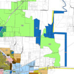
I added the Inland Lakes map for this region, and with that there are depth chart for even the most obscure lakes in the area. Until I had this card, I could mark spots (arguably the most valuable function of any GPS), but I could not go out on the water and know the depths below my kayak. Now, adjusted for actual lake levels, I can see contours below, and follow them with a higher degree of fishing success. In a word, indispensable.
Earlier this week, I turned my GPS on at home and it stuck on the “acquiring satellites” screen with no apparent progress toward acquiring the satellites. Several restarts later, I realized I was not going to be able to solve the problem with restarts, and went to the Garmin site. After updating two parts of firmware directly downloaded and installed from Garmin, the unit was up and running again – and acquired satellites even quicker than in the past.
There is a (*) hardware problem with the Garmin 60CSx. The door that holds and supposedly locks the microSD card behind the batteries comes loose and open with some jostling and jarring. So, the card is rattling around behind the batteries which means it does not connect or provide information located on the card. Dealing with this was difficult in typical boating conditions, and often temporary. The solution: cut a rectangular piece of thin craft foam (the kind we use for tying gurgler patterns but thinnest possible), and place it behind the batteries and over the compartment. That pressure will insure the card stays in contact even if the door is jarred open. While you are at it, cut a couple of these because it is possible for them to be blown away by the wind while replacing batteries.
Now for the battery issue; GPS units consume batteries, and this one is no different. I use my unit to go to find locations then to find fish, so it is easy to go through a set (2-AA) of batteries on a single outing. Carry extra batteries, and stick to the manufacturer’s advice to not use rechargeable batteries (too high powered). If you can imagine all the work one of these units is doing, it’s easy to see why they consume batteries the way they do!
Bringing it all Home
Knowing where you are is one thing. Knowing how to get there again is another. That is what makes GPS so great. For instance, I occasionally tweet GPS coordinates for where fish are currently being caught. If you have the ability to key in those numbers, you can float within a fly rod length of that same spot. So, part of the routine of getting home from an adventure is downloading all the data and routes from a trip and saving them on my computer, for backup or for sharing. No matter what, it’s fun to look at the drifts, and see where the fish were marked – all on a big screen. It allows me to share information like the routes and coordinates below.
If you believe in applying modern technology to the ancient art of fly fishing, then a GPS unit should be on your list. Personally, I enjoy telling people how to get there, and then hearing how or if they actually found “the spot”. You are welcome to share GPS coordinates here, and






You mean you can make money on this newfangled internet thing? No way!
you should try and market this stuff to a site that pays for reviews on products (if these don’t exist they should).